July 10

Day 20 A revisited Newport to Dunbeath

Well, finally, the missing link in our trail from Ponte Caffaro to John o’Groats completed. What a glorious day it was too. we set off down the hill from the Halfway House Hostel at Newport and bore left.

Map of the route “Day 20 A revisited Newport to Dunbeath”: 6.14 mi, 809 m of climbing and 877 m of descent, elevation between 1 m and 141 m, time 04:28:59. It starts at 58.19559, -3.48707 and ends at 58.24710, -3.43993 (latitude, longitude).
July 1

Day 20 revisited Helmsdale to Newport

At last we have completed this section. Today is 30th June 2023.
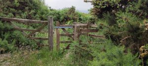
A truly glorious day. Thanks to the John o’ Groats trail volunteers. The gorse and bracken laid low and new signs erected.
Five years ago we arrived at this point and were met with an barrier of gorse and of bracken. A local volunteer also had to turn back. More photos to follo when I have internet.

Map of the route “Day 20 revisited Helmsdale to Newport”: 8.99 mi, 863 m of climbing and 855 m of descent, elevation between 6 m and 204 m. It starts at 58.13452, -3.61692 and ends at 58.19544, -3.48700 (latitude, longitude).

September 1

Day – 28 Kinbrace to Kildonan

IMG_20220527_094659

IMG_20220527_101946

IMG_20220527_102333

IMG_20220527_102351

IMG_20220527_124706

IMG_20220527_132628

VID_20220527_135346

Map of the route “Day – 28 Kinbrace to Kildonan”: 8.34 mi, 145 m of climbing and 210 m of descent, elevation between 59 m and 157 m, time 03:47:31. It starts at 58.25860, -3.94106 and ends at 58.17058, -3.86790 (latitude, longitude).

May 26

Day 27 Between Kildonan and Helmsdale

After a lapse of a few years the ancient strollers and their ancient legs are intending to fill in the gap left in our meandering walks between the UK and Italy. The plan is to stroll to Wick from Helmsdale up Strath Helmsdale. The recce having been done in the two days we could spare we have the route.

IMG_20220526_093502
There is an emergency timetable in operation by Scotrail at the moment so we were a tad nervous that the only train to Kildonan might not arrive this morning.

IMG_20220526_100442

To get to the rather delightful A897 one leaves the halt at Kildonan and over a bridge to a track on the right.

IMG_20220526_100528

IMG_20220526_100806

IMG_20220526_101935

IMG_20220526_103053

IMG_20220526_121904

IMG_20220526_123712

IMG_20220526_123657

IMG_20220526_125813
IMG_20220526_135631

IMG_20220526_135631

IMG_20220526_143954

IMG_20220526_144047

IMG_20220526_144757

IMG_20220526_145438

IMG_20220526_145458

IMG_20220526_182634

Map of the route “Day 27 Between Kildonan and Helmsdale”: 10.85 mi, 215 m of climbing and 255 m of descent, elevation between 13 m and 68 m, time 04:50:11. It starts at 58.17071, -3.86893 and ends at 58.11724, -3.65395 (latitude, longitude).